Location & Community
- Home
- Location & Community
Plan Your trip
Where are we and how to get to Sadiri Lodge?
We are located in the Northern Amazon region of the Department of La Paz, Bolivia, Municipality of San Buenaventura, Iturralde Province, within the Community Territory of Origin (TCO) San José de Uchupiamonas Indigenous Territory and Madidi National Park.
Sadiri Lodge is located at this meeting point between the mountain chain of El Tigre and El Bala, to the East of Madidi National Park and Integrated Management Natural Area, just three hours from Rurrenabaque by road.
You can reach Rurrenabaque from the main Bolivian cities of La Paz, Santa Cruz and Cochabamba via airlines Ecojet and Boliviana de Aviación BoA.
Flight Schedule
The airline schedules are as follows, please be advised these may vary
From La Paz to Rurrenabaque
From La Paz to Cochabamba
From Santa Cruz via La Paz
- From La Paz to Rurrenabaque with Ecojet, on Mondays, Wednesdays and Fridays at 08:30 am.
- From santa Cruz via La Paz on Mondays, Wednesdays and Fridays at 06:00 am with Ecojet and at 5:55 am with BoA, with connection in La Paz at 08:30 am with Ecojet.
Alternatively, you can travel by land from the city of La Paz in Ipsum cars, with a travel time of 9 hours or by bus, with a travel time of 12 hours, from Villa Fátima, with daily departures.
Finally, if you are traveling from Santa Cruz, there are commercial flights from Santa Cruz to Trinidad. From Trinidad Ipsum cars are available to Rurrenabaque, with a travel time of 5 hours, or by bus with a travel time of 8 hours, with daily departures.

Heritage & Nature
Indigenous Community of San José de Uchupiamonas
This Indigenous community safeguards vast ancestral rainforest, blending tradition, conservation, and eco-tourism in the Amazon–Andes region.
Chronicles from the Spanish colonial period refer to the existence of 24 Indigenous nations in the territory now known as northern La Paz, Bolivia. Among these documents, the Uchupiamonas and Sipiramonas are mentioned as the ancestral inhabitants of the Tuichi River valley.
During the time of the Inca Empire, these territories became part of the administration of the Antisuyo region. This is evidenced by the remains of the Inca road that originated in Cusco (Peru) and extended to the cloud forests of Pelechuco (Bolivia). This road descended, connecting settlements such as Mojos and Pata, until it reached the plains of the Tuichi, where the Uchupiamonas lived, in a place currently known as Biwa.
From this point, the Inca road continued toward the plains of the Mashi, crossing the Maije mountain range, where vestiges such as stone enclosures can still be found today. This route was one of the main paths used by the Inca Empire in its attempt to conquer the Kingdom of Mojos. Likewise, a second route departed from Biwa, crossed the plains, and traversed the Tequeje mountain range, where stone structures can also be found. This route was built with the purpose of advancing toward the plains of Madre de Dios.
The roads from the Inca period later served as access routes for Spanish incursions. Initially, the conquest was based on military campaigns. Upon learning of the arrival of the Spaniards, the Uchupiamonas and Sipiramonas, led by Chief Arapo along with Chief Taramo, fought against the Spanish army on the plains of the Samo River, now known as the Heath River. In this battle, they managed to defeat the Spanish forces, killing Captain Álvarez Maldonado near the Madre de Dios River in the year 1575.
Despite this defeat, the Spaniards changed their strategy. In their effort to reach the lands of Mojos in search of the Great Paititi (El Dorado), expeditions began to be led by religious missionaries, who traveled carrying the cross and a parchment bearing the message of peace of Jesus Christ. On March 19, 1616, the Spaniards arrived at the capital of the Uchupiamonas, located on the plains of Inarama along the Tuichi River. This encounter culminated in a pact of conversion to Christianity by the Uchupiamonas people, symbolized by the planting of a cross at the entrance to the capital. Since then, crosses can be seen at the entrance of the Indigenous community of San José de Uchupiamonas, a tradition that continues to this day.
For the Uchupiamonas, who still inhabit the Tuichi Valley today, history shows that despite the profound changes that have taken place since pre-colonial times, their living culture and close relationship with nature remain intact. Their smaller rivers—such as the Tachapo, Sanchapo, Yuriyapo, Sipillapo, Sarapiapo, Mechapo, and Yariapo, among others—flow into the Tuichi River, as do their mountain ranges, including Eslabón, Maije, Cakiawaca, and Tequeje, which still preserve significant vestiges of the Inca Empire’s expansion.
Many historians currently consider San José de Uchupiamonas to be the last Inca stronghold in the attempt to conquer the Kingdom of Mojos.
Today, the ancestral territory of the Uchupiamonas overlaps with the Madidi National Park and Integrated Management Natural Area, created in 1995 and considered by researchers to be one of the most biodiverse protected areas in the world. Since 1999, the Uchupiamonas have opened their doors to travelers, offering a unique experience of living in harmony with nature through community-based ecotourism.
Currently, the Uchupiamonas have developed seven community-based tourism initiatives as a strategy to protect their ancestral territory and water sources, with Sadiri Lodge being one of these initiatives.
Currently, access to San José is exclusively by land. The town is no longer accessible by river. The land route from Tumupasa to San José is approximately 30 km long and, while not in perfect condition, is no longer considered perilous. Importantly, this route is now accessible year-round.
Despite these improvements, transport costs remain high, and road conditions still pose challenges for logistics. Limited road reliability continues to constrain San José’s economic viability and makes it difficult to establish consistent trade and marketing commitments.
The community of San José’s main sources of income come from the dividends of the Chalalan Company, a community ecotourism project recognized at an international level.
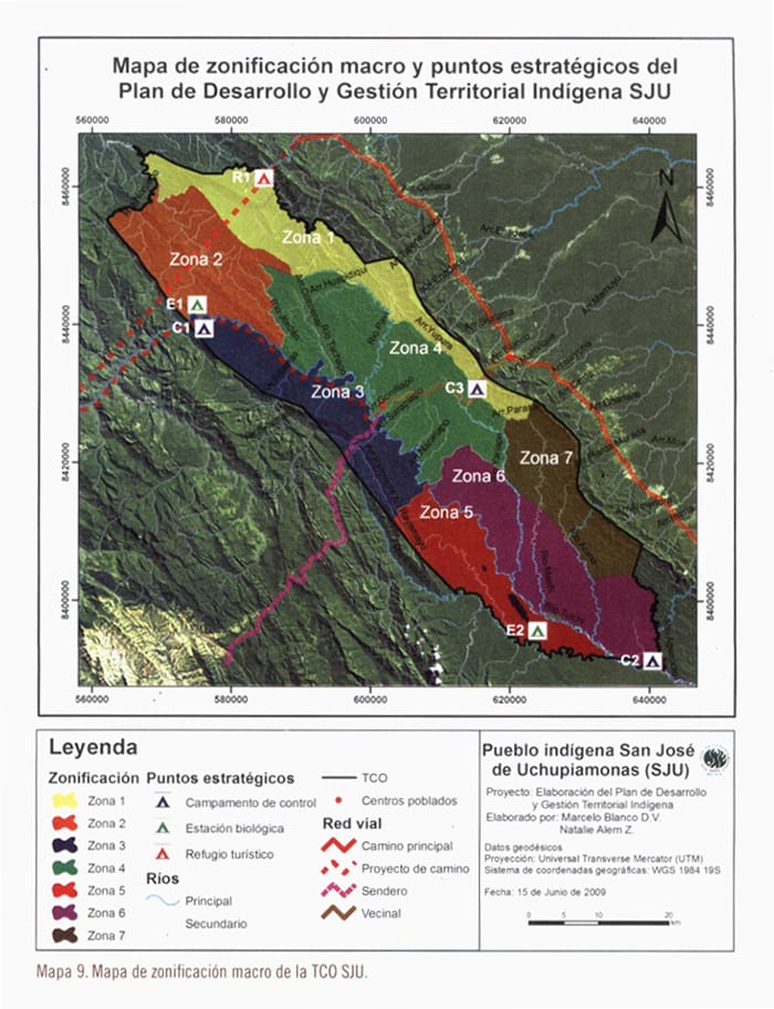
The “San José de Uchupiamonas’s Territorial Management and Development Plan.” (PDGTI-SJU) was created to clearly systematize the dreams of the people in terms of human development, make a plan of land use, occupation of land and natural resource management. Assess threats and design a program to achieve those dreams and deal with possible threats.
With this document the community expressed their willingness to continue with their customs and traditions at the level of organization of the people and keep a traditional style in the construction industry.
Map of macro zoning and strategic points of “San José de Uchupiamonas’s Territorial Management and Development Plan.”
We define the topography of the village as a small plateau surrounded by canyons and slopes in a mountainous landscape. The hydrography of the river consists mainly of the Tuíchi River located 2 km south from the twon, and several nearby streams,like the River Pavi and River Uchupiama, at a distance of approximately 2 km to the west.
San José de Uchupiamonas is located 517 meters above sea level. According to the National Service of Meteorology and Hydrology of Bolivia (2002), the annual rainfall is 1,927 mm. The rainy season covers the months of November to February and the dry season corresponds to the months of May to October.
The average temperature is 25 º C, the highest temperatures occur between October and January and can reach 33 ° C. Between the months of March through June it is hit by cold fronts “surazos” that determine a drop in temperature to below 10 ° C and a sharp increase in moisture by light rainfall.
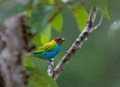
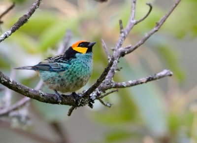
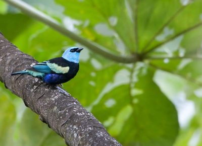
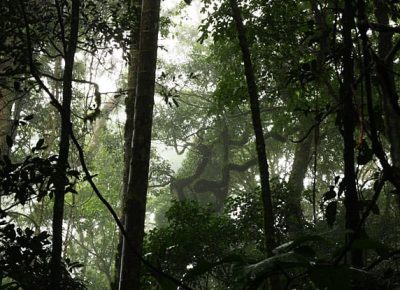
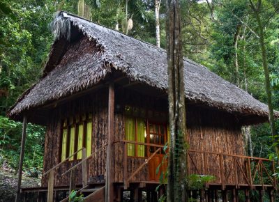
Sadiri Lodge rests in a lush, biodiverse rainforest at the Andean foothills, where cool climate, rich soils, and abundant rainfall create a sanctuary for extraordinary wildlife.